Designing location-specific COVID-19 guidance under extreme time pressure
In late 2020, COVID-19 restrictions changed frequently and varied by location. Guidance was often difficult to interpret, creating confusion at a time when clarity directly affected public trust and compliance.
I joined the GDS emergency response team as the sole product designer, responsible for designing two services: Local Checker and Travel Checker. Both services were designed to deliver location-specific guidance (via postcode) under extreme time constraints and evolving policy requirements.
Design judgment
I optimized for speed and clarity in order to help end-users understand the latest COVID restrictions so they could make informed decisions during this watershed moment.
Design decisions
Consistency between the two checkers via similar flows of entering postcode(s) to eliminate ambiguity and avoid complex regional mapping
Clear output highlighting to users relevant information, then allowing them to learn more via available guidance
High-fidelity prototyping in code using the GOV.UK Prototype Kit to validate user-flow, accessibility, content design, and edge cases during user testing sessions
Design artefacts
Early user flow exploration
Early sketch of a user flow using the postcode checker
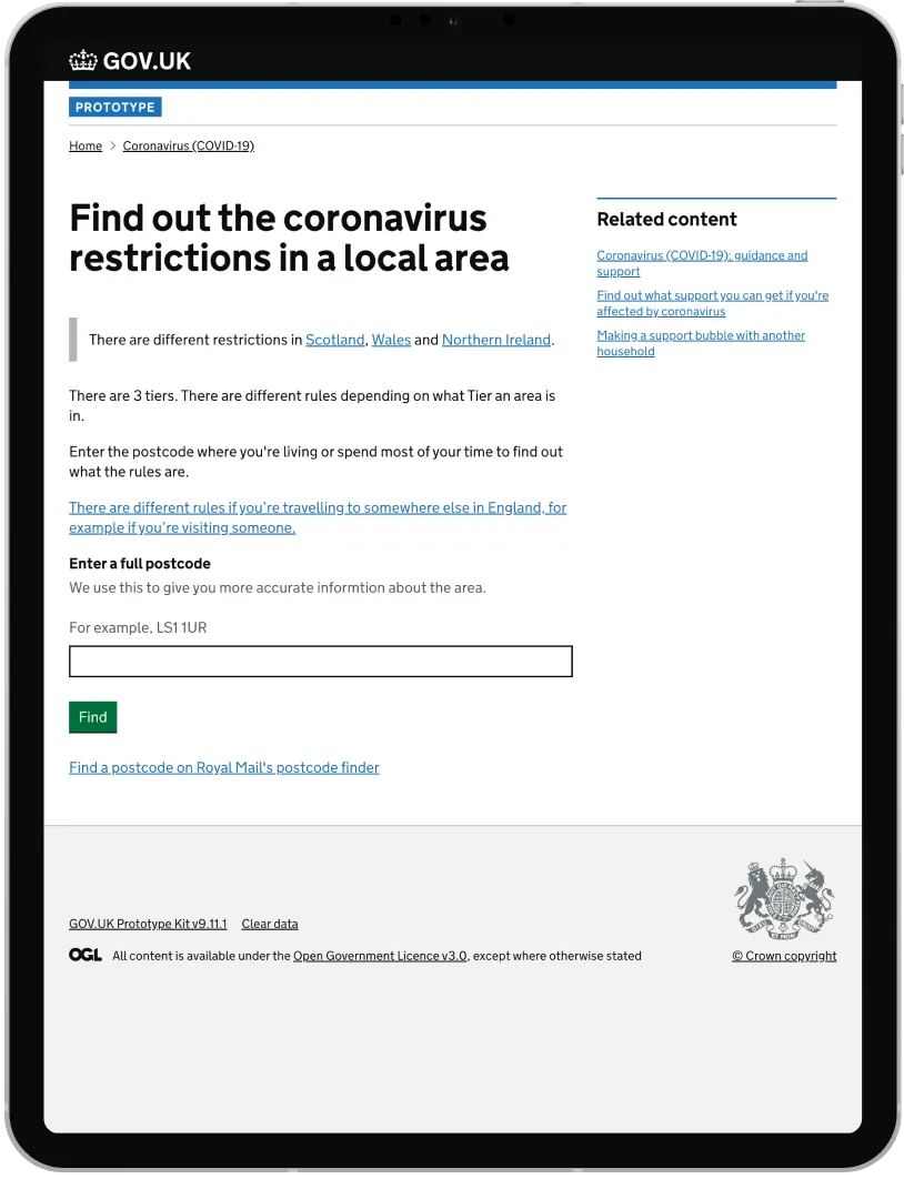
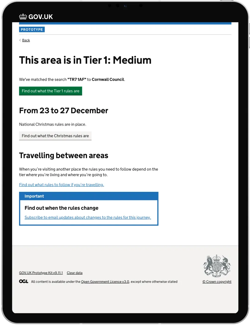
High-fidelity prototype: Local Checker
Figure 1
Figure 2
Figure 1: Start page for Local Checker. Figure 2: Results page for Local Checker.
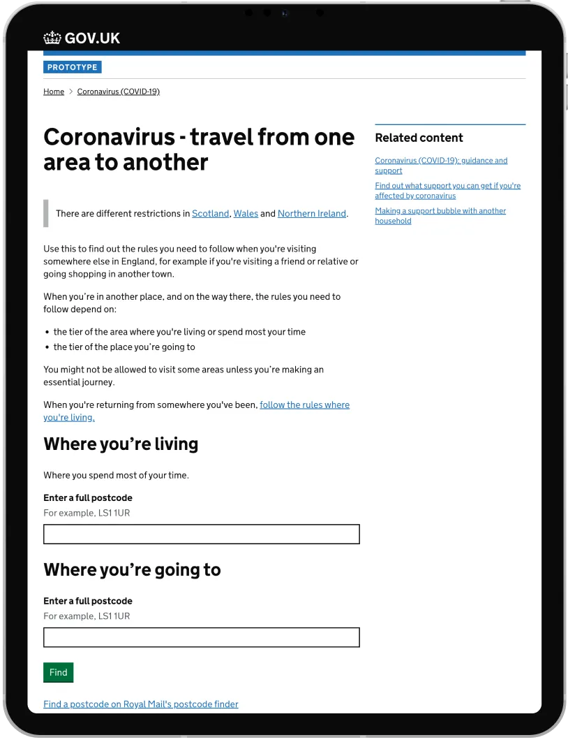
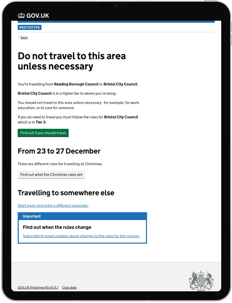
High-fidelity prototype: Travel Checker
Figure 3
Figure 4
Figure 3: Start page for Travel Checker. Figure 4: Results page for Travel Checker.
Impact
100% task success in testing: Participants consistently understood their local restrictions and the restrictions of where they would be travelling to
Demonstrated how design can help end-users especially during a high stress watershed moment
The prototype influenced senior leadership's decision to invest in upgrading internal tools. The service itself didn't ship due to CMS limitations, but the work shifted how the organization thought about content as structured data.